Art exploring the connection and flow between humans and the rest of nature
Big Stone Lake Stories – 2018
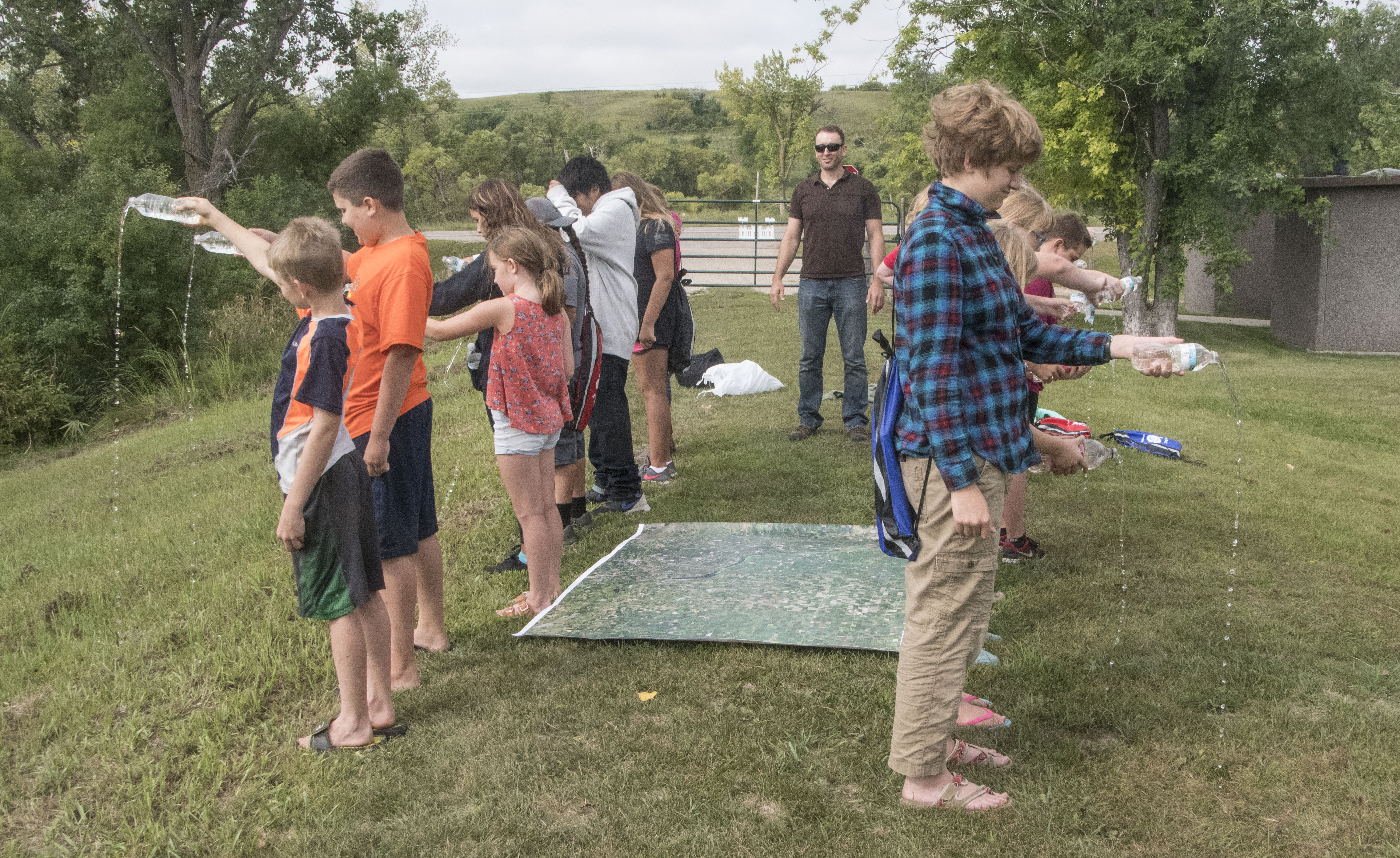
Land Markings (Detail)Words for Water (Photo by John White)Continental Divide Directed by Jonee Brigham, campers create a human sculpture about the continental divide, with hydrologist, Ryan Bjerke, standing between the two waters flowing north to Canada, and south to the Gulf of Mexico. (Photo by John White)Big Stone Lake Stories is an art-science camp based on the Earth Systems Journey model, to explore ways of knowing stories of water and its interconnections across the human and natural landscape specific to a place. It takes place at Bonanza Education Center, Monday, August 13-Saturday, August 18, along the shores of Big Stone Lake, but will take campers all along the length of Big Stone Lake as they explore water connections of meaning, history, water quality, geology, hydrology, ecology, and beauty. Along the way they will make art in the form of collage art maps and images that will be integrated into an online interactive storytelling map using geographic information system software (GIS). The art will be a way to understand and explore as well as express water connections. At the end of the week, campers conduct a stewardship project integrated with the art-water-science journey, present their story and learning to the community, and engage the community in an interactive water mapping experience. Later, artifacts from the camp will be on display at Bonanza Education Center as part of the Meander Arts Crawl in October. Documentation in progress.
Overall Big Stone Lake Stories Project:
Medium: Designed experience supported by multiple objects: interactive map, photographs, visual journals, interactive water vessel, project documentation in exhibit
Dimensions: Big Stone Lake Area approximately 26 miles from end to end, engaging both sides of the lake
Date: August 13, 2018 – August 18, 2018
Location: Bonanza Education Center, Big Stone County and surrounding area, and final presentation at Corn Fest, August 18, 2018 in Ortonville, MN
Land Markings (Detail), 2018
Media: Sanded digital print of satellite map* on artist canvas, Embroidery floss, chalk-painted pine
Dimensions: 64 in. w x 54 in. h x 1.5 in d
*Assistance from GIS Specialist, Micaella Penning
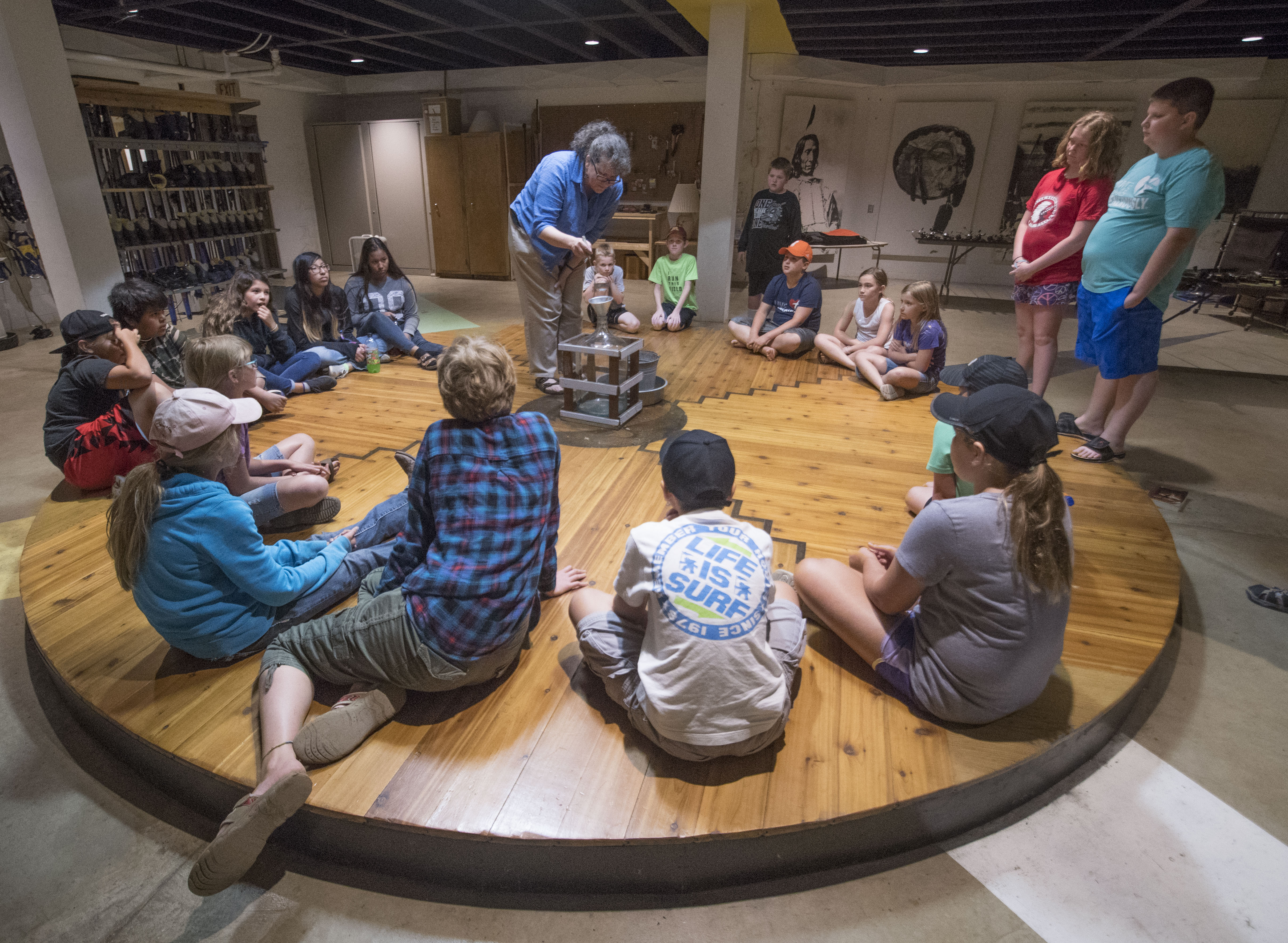
Words for Water, 2018
Media: Vintage glass water vessel, altered vintage crate, chalk paint, artist canvas, pencil, metal bucket, pan, funnel, sanded ladle
Dimensions: Crate and Vessel: 15 in w x 15 in d x 26 in h; Implements for pouring: 22 in diameter x 16 in h
Continental Divide, 2018
Media: Human, place-based sculpture, youth campers, hydrologist guide*, plastic water bottles, water from Lake Traverse, map
Dimensions: 12 foot w x 20 foot d x 6 foot h area engaged with small parkland around it.
*Planning assistance from DNR Hydrologist, Ryan Bjerke